The Kochi Municipal Corporation in association with the World Resources Institute India organized a ‘Mapathon’ in coordination with the Centre for Heritage, Environment and Development, as part of the Cities4Forests project from 9 to 11 January, 2020 at St. Teresa’s College, Kochi to develop monitoring mechanism in Kochi and enhance community participation in restoration.
Kochi is the only city in the country to have been selected for the project last year. In the first phase of the project, councillors from the Corporation’s 74 divisions along with local experts participated in the mapathon which identified the current land use in the divisions using satellite images. The purpose of the mapathon is to establish baseline and assess the trends in tree cover and identify potential areas for restoration in the city. Buildings, green patches, open spaces, waterbodies and roads were also mapped by WRI in consultation with the councillors after which they identified the areas in their divisions where trees can be planted. The three-day exercise will result in a map that can suggest spaces in the city that are conducive to the growth of green patches.

In the second phase of the project, the Corporation will determine the implementation of the project and which trees are to be planted.

News, Ongoing Projects, Programs, Uncategorized
- Request for Quotation for E-KART
Click here for details
- VACANCY
VACANCY – DRIVER CUM OFFICE ATTENDANT VACANCY – ACCOUNTS ASSISTANT
- Tender Notice: Civil works for Dialysis Center, Lab, and Store room at Palluruthy Government Taluk Hospital in Division 19 of Kochi Municipal Corporation
Tender Notice: Civil works for Dialysis Center, Lab, and Store room at Palluruthy Government Taluk Hospital in Division 19 of Kochi Municipal Corporation Bidders are requested to go through all the documents for Bid submission provided below: NOTICE INVITING TENDER FORM OF TENDER BID DOCUMENT BoQ PRELIMINARY AGREEMENT AFFIDAVIT
- Request for Quotation – UPS
Click here to view the details. Last date for submission of Quotation extended
- Tender Notice for Supply and Installation of lights
Tender Notice for Supply and Installation of flood lights
- Tender Notice for Solar Panel
Tender notice for solar panel installation
- Tender Notice-Biogas plant
Tender Notice – Biogas plant
- Request for Quotation – Desktop, Laptop, printer, CCTV system with camera
Please click here for details.
- Request for Quotation- Dialyser Reprocessing Machine
Please click here for details. Last date for Submission of Quotation Extended
- sdfsdf
- Call for tender – Office equipments
Tender Notice – Office Equipments
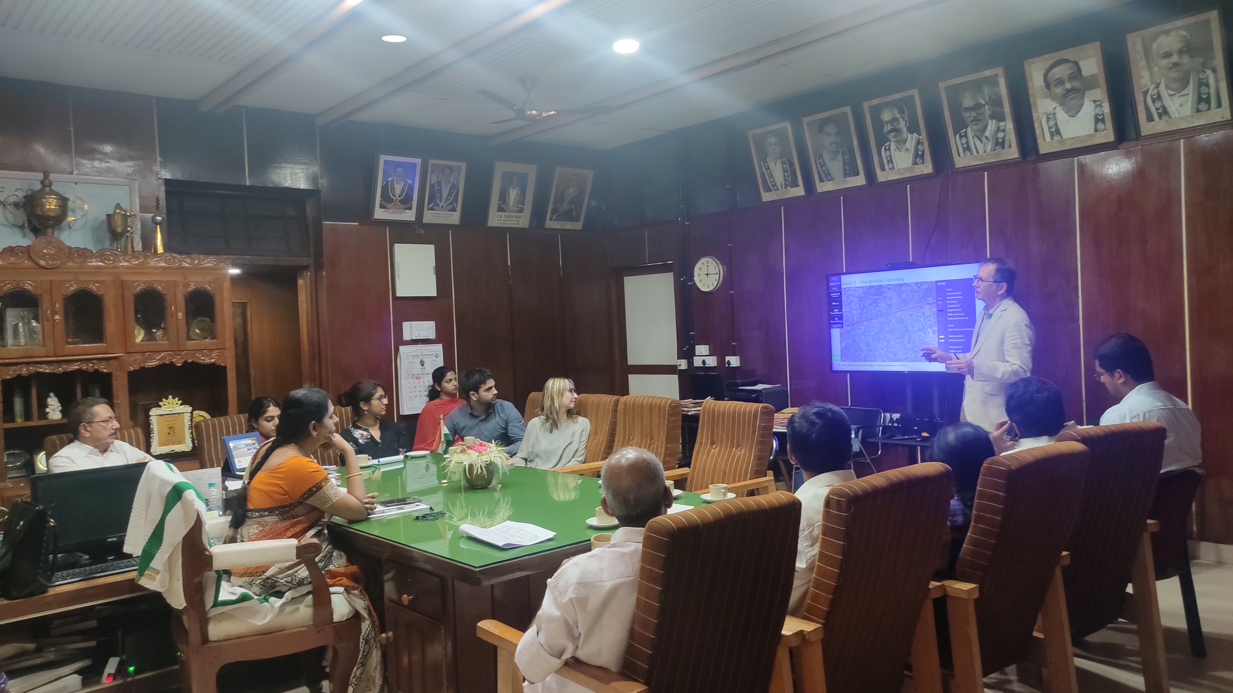
- TOSCA Installation and Demonstration
The TOSCA installation and demonstration was held at Centre for Heritage, Environment and Development (C-HED) as part of TOSCA India – the Toolkit for Open and Sustainable City Planning & Analysis project implemented with the support of Deutsche Gesellschaft für Internationale Zusammenarbeit (GIZ) GmbH. The project is envisioned to address the critical urban challenges and
- Challenge Lab Kochi
Challenge Lab Kochi – A technical workshop was organized by Deutsche Gesellschaft für Internationale Zusammenarbeit (GIZ) GmbH that aimed to develop a granular understanding of city’s needs and priorities, challenges and enablers for setting up the Urban Observatory as well as programming and management of public open spaces. The event was formally inaugurated by the
- Launch of 100 E-Autos
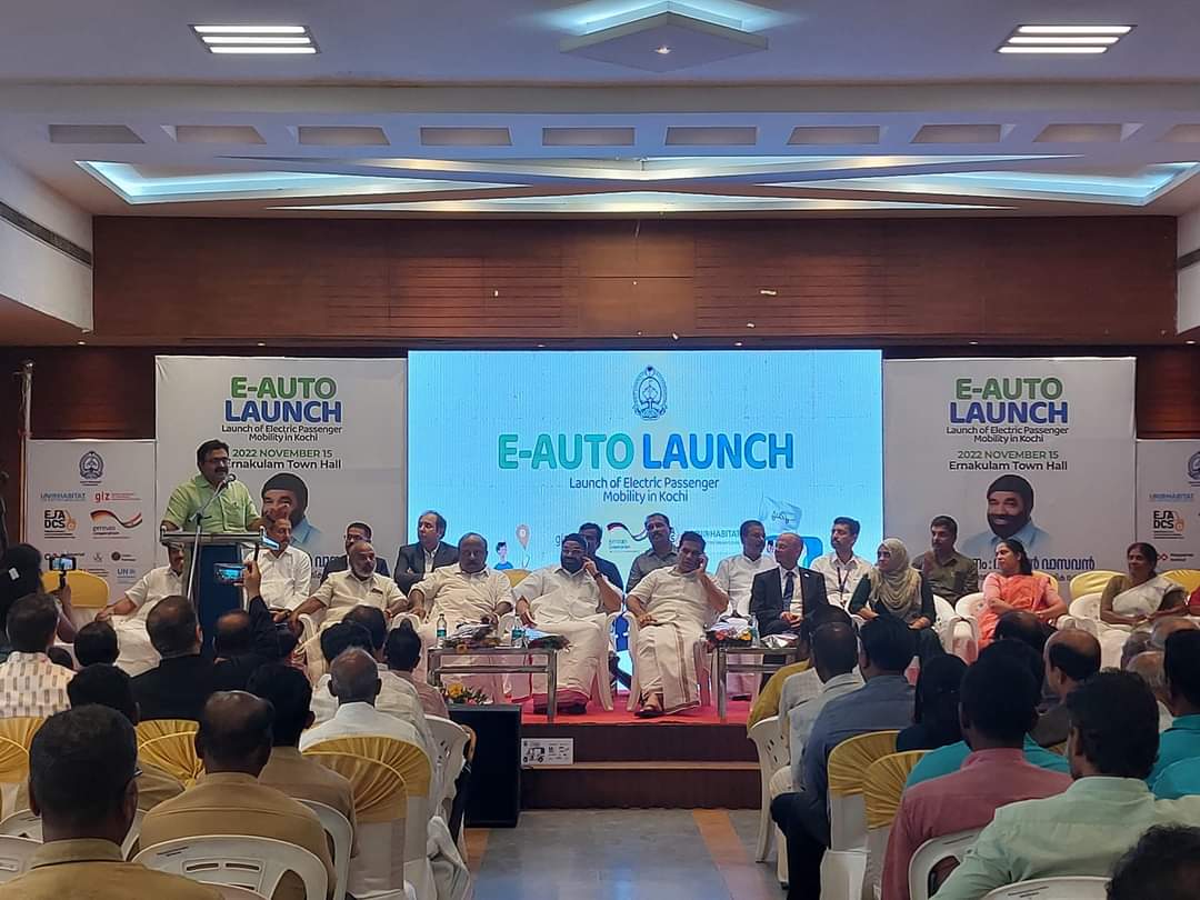
The launch programme of 100 E-Autos as part of Smart SUT project under GIZ and Urban Pathways project under UN Habitat.
- Kochi – City of Design
The first Steering Committee of Kochi – City of Design.
- Urban Sustainability and Smart City (USSC) Event
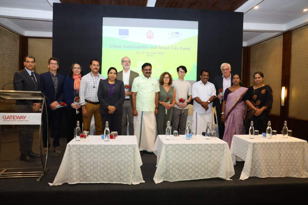
The India-EU Urban Partnership (IEUP) project between the Ministry of Housing and Urban Affairs, Government of India and the European Union aims to support the implementation of smart, resilient and sustainable urban development in India under the ‘Road Map -2025’ of India-EU bilateral co-operation. In an interaction in early 2022, the Government of Kerala and
- Visit of Dutch Water Experts
As part of the ongoing discussions the Hon’ble Mayor has been having with Sri. Venu Rajamony IFS, Officer on Special Duty (External Cooperation), Government of Kerala and Former Ambassador of India to the Netherlands and the Dutch water experts, a delegation of experts visited areas of Kochi city being inundated during heavy rains. The purpose
- EcoLogistics project – Inauguration and handing over of Zero- Emission Electric Freight Autos
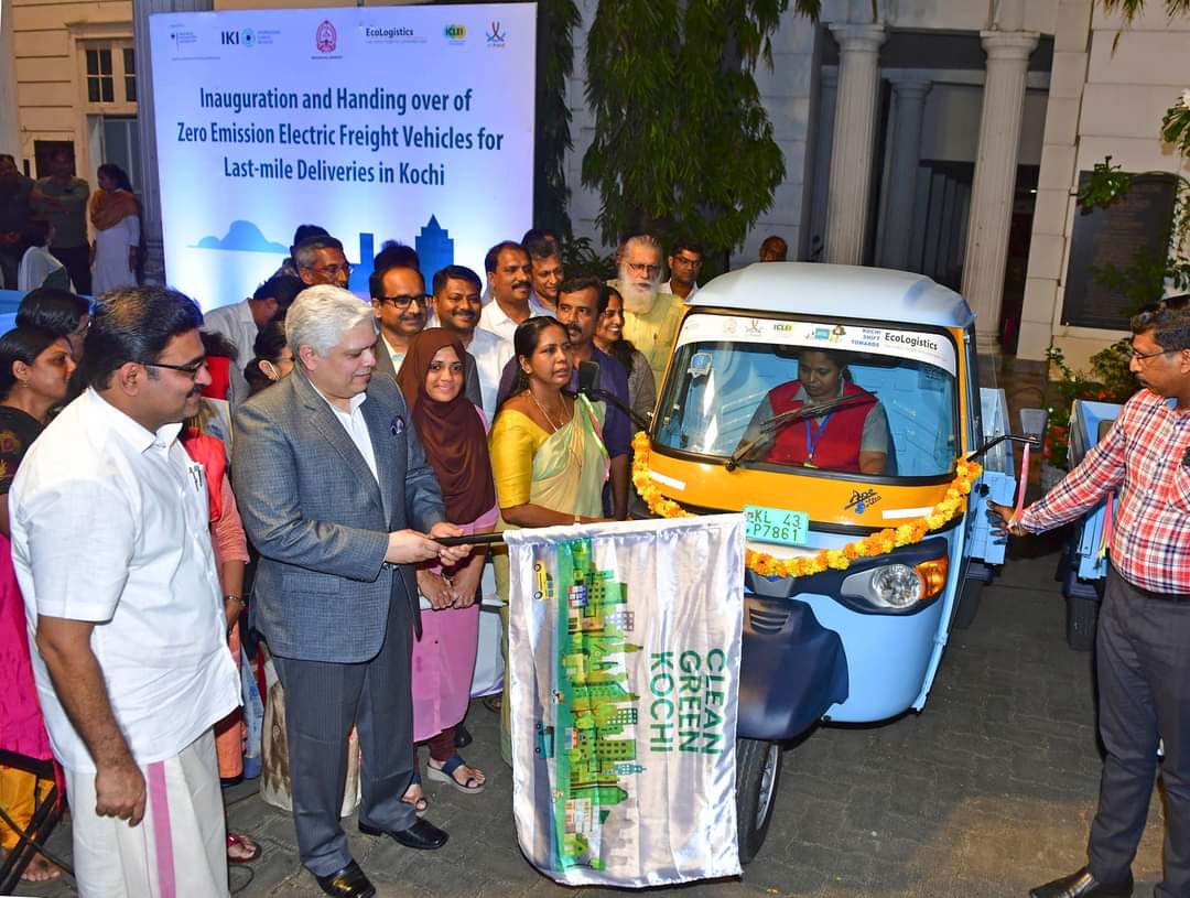
Kochi showcases a way forward to address the complex problems of decarbonising urban logistics, air pollution, climate change, and gender inequality. Hon’ble Justice Shri Devan Ramachandran of the Kerala High Court and Hon’ble Mayor Adv.M Anilkumar inaugurated a demonstration project on September 15, 2022, to promote zero-emission light goods vehicles for last-mile deliveries under EcoLogistics
- Towards Plastic Less Kochi Campaign
The steel water bottle distribution held at Government Girls L.P School, Ernakulam and SRV Government Higher Secondary School, Ernakulam as part of ‘Towards Plastic Less Kochi Campaign’.
- Call for Tender
Tender Notice – Bhaav
- Training programme on the vacant land survey and retrieving land survey details from GIS platform
Training programme on the vacant land survey and retrieving land survey details from GIS platform held as part of the ‘Rapid Response Policy Engagement’ project.
- Workshop on Advancing Climate action in Kochi – Facilitating c-hed’s priorities as Kochi’s designated cell for climate action
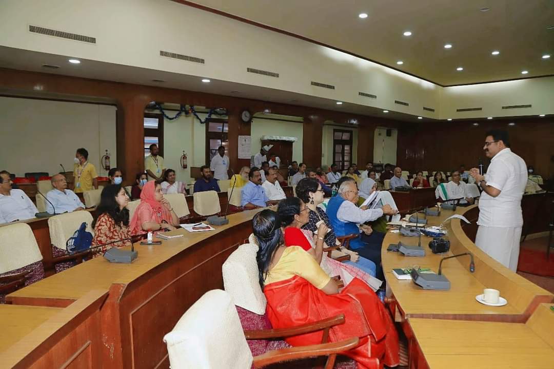
Workshop on ‘Advancing Climate action in Kochi – Facilitating c-hed’s priorities as Kochi’s designated cell for climate action’ was held to explore the opportunities of further integrating multiple climate resilience and adaptation programs in Kochi. The event had the participation of major stakeholders in the city.
- Inauguration and handing over of Zero- Emission Electric Freight Autos
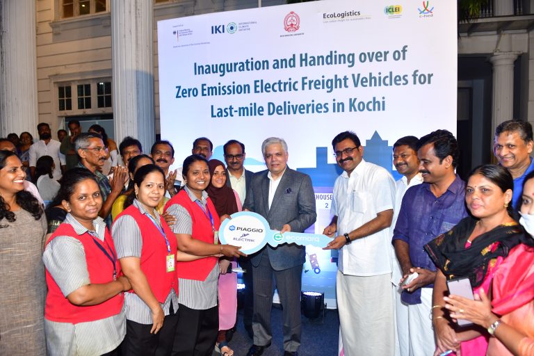
Kochi Municipal Corporation showcases a way forward to address the complex problems of decarbonising urban logistics, air pollution, climate change, and gender inequality. Hon’ble Justice Shri Devan Ramachandran of the Kerala High Court and Hon’ble Mayor of Kochi Shri Adv.M Anilkumar inaugurated a demonstration project on September 15, 2022, to promote zero-emission light goods
- VACANT LAND SURVEY – DATA HANDING OVER CEREMONY
The vacant land survey data handing over ceremony held as part of the ‘Rapid Response Policy Engagement’ project done with the support of University of Reading, UK and SCMS School of Architecture. The is project is co-ordinated by c-hed.
- MoU signed between c-hed and MG University
A Memorandum of Understanding was signed today between the Centre for Urban Studies and Centre for Heritage, Environment and Development (c-hed) to work together on urban development, public governance, urban studies and research activities. The programme was attended by the Hon’ble Mayor of Kochi Adv. M Anilkumar, Hon’ble Vice Chancellor of M G University
- Stakeholder discussion on “Transforming adoption of E-Autos in Indian Cities” initiative
The stakeholder discussion on “Transforming adoption of E-Autos in Indian Cities” initiative held at Kochi Municipal Corporation council hall.
- Towards Plastic Less Kochi Campaign
Prabhat Pheri and the inauguration of the Plastic waste collection box held as part of ‘Towards Plastic Less Kochi Campaign’ at Ernakulam Boat Jetty. Prabhat Pheri held as part of ‘Towards Plastic Less Kochi Campaign’ at Thevara.
- Inauguration of setting up of Water Treatment Plant at Subhash Bose Park and the Kick off of ‘Towards Plastic Less Kochi’ Campaign
The inauguration of setting up of Water Treatment Plant at Subhash Bose Park and the Kick off of ‘Towards Plastic Less Kochi’ Campaign were held at Subhash Bose Park on July 8, 2022.
- Inauguration of the Mini Nature Interpretation Centre and the release of the Handbook on ‘Trees of Fort Kochi and Mattancherry
The inauguration of the Mini Nature Interpretation Centre and the release of the Handbook on ‘Trees of Fort Kochi and Mattancherry’ were held at Subhash Bose Park.
- World Environment Day 2022 – Kawaki project launch
The launch of the Kawaki project as part of the World Environment Day celebration was held at Subhash Bose park, Kochi
- European Union – IURC delegation visits the Greater Cochin Development Authority
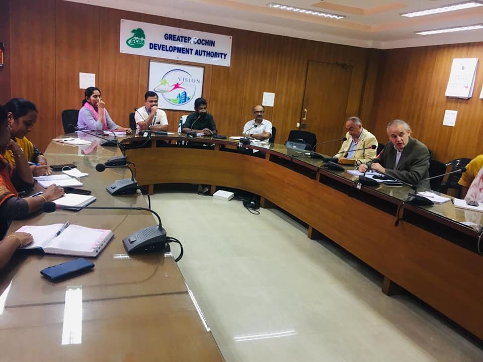
The European Union – IURC delegation visited the Greater Cochin Development Authority (GCDA) and held discussion with the Chairman Sri. K Chandran Pillai and team.
- European Union – IURC delegation visits Cochin Port Trust
The European Union – IURC delegation visited the Cochin Port Trust and held discussion with the Chairman Dr. M. Beena IAS and team.
- European Union – IURC delegation visits Advanced Centre for Atmospheric Radar Research, CUSAT
The European Union – IURC delegation visited the Advanced Centre for Atmospheric Radar Research of the Cochin University for Science and Technology and held discussion with Dr. Abhilash. S, Director, and team.
- EU – IURC delegation visits CSML
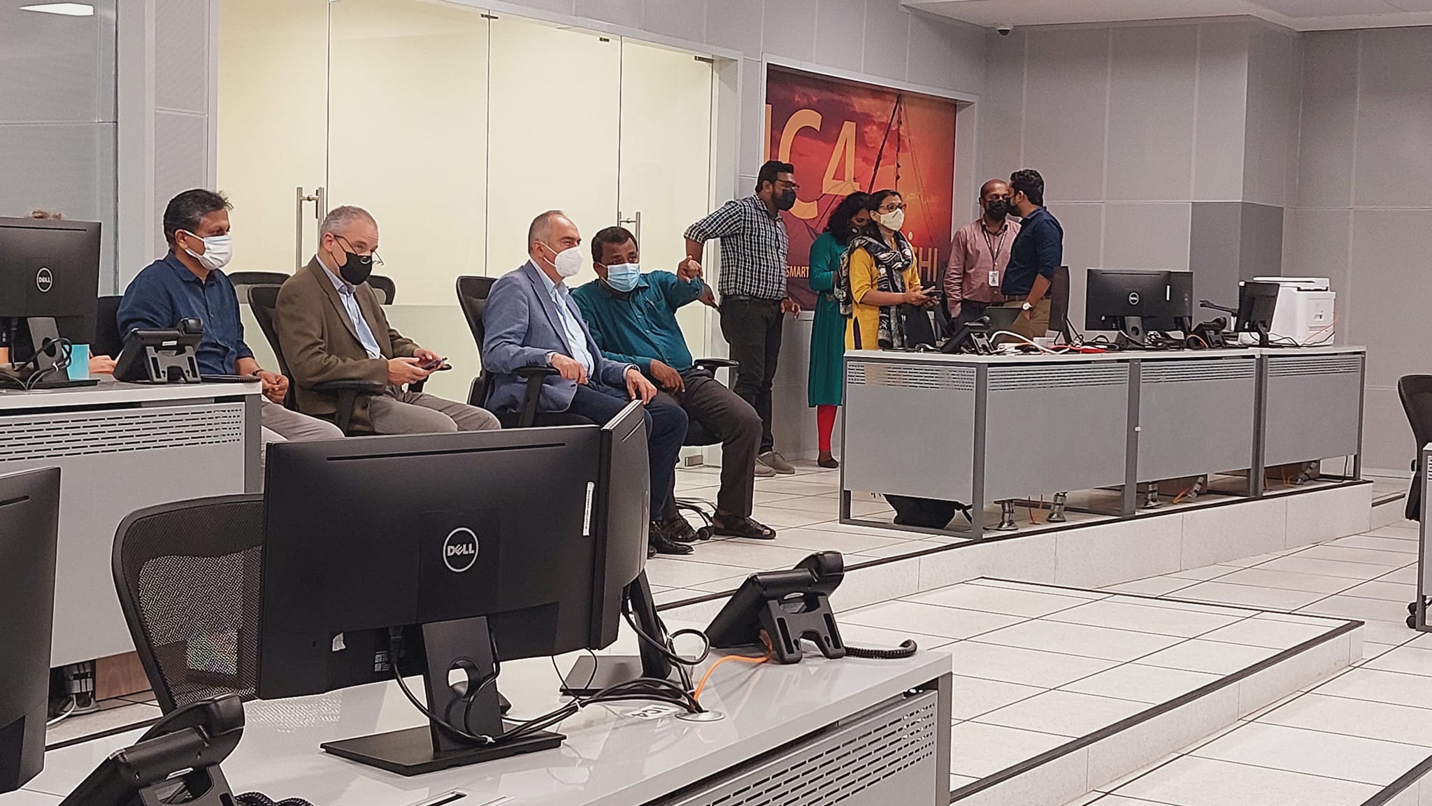
The visiting EU – IURC delegation had a detailed discussion on Kochi’s smart city project and programmes. Sri. Shanavas IAS , CEO , CSML briefed the delegation about the ongoing projects. They also discussed with the team the programmes and area of cooperation within IURC.
- Mullassery Canal Project – Team visit
Ms. Teresa Kerber, the Project Manager for SUD-SC Phase II project of GIZ visited Kochi to meet with the Hon’ble Mayor and Dr. Rajan Chedambath, Director, c-hed. She was accompanid by Ms. Charlotte Pusch, GIZ, Ms. Fathim Rashna, GIZ, Mr. Esakkiraj S, GIZ. The team also visited the Ente Kochi Urban Design Competition site –
- Morgenstadt Global Smart Cities Initiative (MGI) – Sustainable Neighbourhood project
SITE VISIT AND STAKEHOLDER WORKSHOP As part of the ongoing Morgenstadt Global Smart Cities Initiative (MGI) – Sustainable Neighbourhood project, the project team from Fraunhofer Institute for Industrial Engineering (IAO), Stuttgart, University of Stuttgart, National Institute of Urban Affairs (NIUA) visited Kochi. The team along with the c-hed visited the project area at Elamakkara North
- TUMI – WAY FINDING SIGNAGES INAUGURATION
Kochi Ithile way finding signage project was created based on Reimagining Fort KochiProposal and and Transport Strategy document by SMART-SUT for West Kochi Island withpartners including Kochi Municipal Corporation, Centre for Heritage, Environment andDevelopment (C-HED), and GIZ India , through the Transformative Urban Mobility Initiative(TUMI), funded by the German Federal Ministry for Economic Cooperation and
- KAWAKI PROJECT INAUGURATION
Nature Based Solutions is one of the few important verticals in which Kochi Municipal Corporation is focused on. In this regard Kochi Municipal Corporation is launching the KAVAKI initiative, which focuses on increasing the cities green cover by developing urban grooves of native trees in a data-based approach focusing on the most heat stress vulnerable
- CYCLE WITH KOCHI
Cycle with Kochi was another step to bring together various cycling clubs to participate in a group cycle ride and motivate citizens to participate in the Cycle with Kochi project. Hon. Mayor of Kochi, M Anil Kumar graced the occasion and felicitated the Cycling Clubs Admins for pledging their support. Firoza Suresh Cyc Firoza Bicycle
The city of Kochi is an important place of employment for migrant workers in Kerala. The migrant workers in any urban centre are often forced to live in unhygienic and unsafe conditions. The case to some extent in Kochi is the same. They are often denied the access to safe and fair accommodation in the
- Setting up of Integrated Support Platform for Women Entrepreneurship in Kochi
Empowering women is essential to the health and social development of families, communities and cities. With an emphasis on the economic and social upliftment and security of women, Kochi Municipal Corporation with the support of GIZ India launched the Women Entrepreneurship Project ‘Venture Initiation Program – Women (VIP: Women)’under the SDG and Governance component of
- TRAINING PROGRAMME ON SUSTAINABLE URBAN PLANNING

The Kochi Municipal Corporation and the Centre for Heritage, Environment and Development (C-HED) in partnership with CEPT Research and Development Foundation (CRDF), CEPT University, Ahmedabad with the support of the GIZ India organized an online training programme on ‘Sustainable Urban Planning’ on two consecutive days for government officials and professionals engaged with the urban development
- KOCHI ECO CHALLENGE PROJECT
On the occasion of the World Environment Day 2021, the Kochi Municipal Corporation is launching the ‘Kochi Eco Challenge’ (Kochi Eco System Challenge) project in collaboration with District Haritha Keralam Mission and Suchitwa Mission under the leadership of St. Teresa’s College, Ernakulam and C-HED, the Environmental Division of the Kochi Municipal Corporation. The ‘Kochi Eco
- Auto Ambulance service
An emergency service to cater to the needs of COVID patients, especially transport of COVID patients to hospitals, supply of medicines, oximeter, oxygen cylinder and thermometer and to patients houses, etc kick started yesterday in the city. Covid relief works have been on the radar for Kochi municipal corporation and C-HED has been providing backend
- Policy Presentation- Rapid Response Policy Engagement – Affordable Rental Housing for Internal Migrants
The city of Kochi is an important place of employment for migrant workers in Kerala. Workers from Tamil Nadu have been living and working in the city for decades. In addition, workers from Andhra Pradesh, Telangana, West Bengal, Bihar, Odisha, Uttar Pradesh and many more can be found in the city today. The migrant workers
- Hybrid Workshop – The Morgenstadt Global Smart City Innovation Lab
Kochi is one among the Indian cities selected for ‘The Morgenstadt Global Smart City Innovation Lab’. The project is being coordinated and implemented in the city by the C-HED with the technical support of the University of Stuttgart and Fraunhofer Institute for Industrial Engineering (IAO), Stuttgart. The other prominent institutions that have partnered in this
- Subhash Bose Park Reopening
The prestigious Subhash Bose Park is maintained by Centre for Heritage, Environment and Development. The park is a fine example of our efforts . It serves as the green lungs of the core city and a space for recreation . It is now alive and vibrant with music concerts , performing arts and other cultural
- VISIT OF CONSUL GENERAL OF FRANCE AND AFD INDIA DIRECTOR
The Consul General of France in India Ms. Lise TALBOT BARRE and Agence Francaise de Development (AFD) India Director Bruno Bosle visited the North-South Mobility Corridor project area during their recent visit to Kochi.
- ECOLOGISTICS STAKEHOLDER CONSULTATION MEETING
Today the whole world is facing serious climate change issues, as a result of uncontrolled carbon emissions from various sectors mainly transport sector. Our Kochi is one of the areas that suffers the most from its bitter effects. Unscientific transportation is one of the major problems facing Kochi in this regard. Based on this, several
- RAPID RESPONSE POLICY ENGAGEMENT – ONLINE COLLOQUIUM
An online workshop on ‘Explore Issues and Solutions for Solving Housing Challenges of Migrant Workers in Kochi, Kerala’ was organized as part of Rapid Response Policy Engagement project on March 16, 2021 as part of the comprehensive planning of the recommendations received from the stakeholder workshop held on March 5, 2021. Hon’ble Mayor Adv. M
- URBAN ENERGY TRANSITION – STAKEHOLDER CONSULTATION WORKSHOP
Kochi, one of the major urban agglomerations in the state is seriously pondering on the need for sustainable energy transition. It has been very proactively discussing and engaging with various stakeholders to identify the opportunities and challenges of clean energy projects within the city. In this regard, the urban energy transition project, the brainchild of
- RAPID RESPONSE POLICY ENGAGEMENT – STAKEHOLDER CONSULTATION WORKSHOP
The city of Kochi is an important place of employment for migrant workers in Kerala. Workers from Tamil Nadu have been living and working in the city for decades. In addition, workers from Andhra Pradesh, Telangana, West Bengal, Bihar, Odisha, Uttar Pradesh and many more can be found in the city today. The migrant workers
- CANOPY ART-HOLIC PAINTERS CAMP
Kochi Corporation in association with Kerala Lalithakala Academy conducted Canopy Art-Holic Art Camp of painters on March 4th -6th, 2021 at the Chatiyath Queens Walkway. The three day camp organised as part of the ambitious Arts Space Kochi (ASK) project had 10 renowned artists brushing the colours of the expression of nature on to the
- Road Safety Event organized under ASK
As part of the Road Safety Month campaign, Kochi Municipal Corporation (KMC) jointly with Transport Department, Government of Kerala and Kochi Metropolitan Transport Authority (KMTA) have launched the Road Safety awareness event in Kochi on February 16, 2021. The event was supported by Centre for Heritage, Environment and Development (C-HED) under the initiative ‘Art Space
- ASK MUSICAL EVENT AT KOCHI DURBAR HALL GROUND AND KOITHARA PARK
As part of Arts Space Kochi a live music events was held at Durbar Hall and Koithara Park in Kochi on February 14, 2021. The performances were done by the music band of young techies named ‘Untagged’. The event was inaugurated by the Hon’ble Mayor Adv. M. Anil Kumar. The event was held in association
- ARTS SPACE KOCHI PROGRAMME LAUNCH
Kochi Corporation in association with the district administration in coordination with the Centre for Heritage, Environment and Development (C-HED), launched Arts Space Kochi (ASK) on February 8, 2021 Monday in an effort to encourage arts, particularly in public spaces. The project kicked off with an inaugural event at the cultural corner of Kochi Metro Rail
- Biodiversity strategy and action plan for Kochi
The Kochi Corporation has prepared a local biodiversity strategy and action plan which sets 29 goals for the city to achieve on biodiversity conservation by 2025. The city is the first in the country to develop a ‘scientifically informed and participatory’ action plan, according to Mayor Soumini Jain’s message in the plan. The plan was
- Kochi City Biodiversity Index
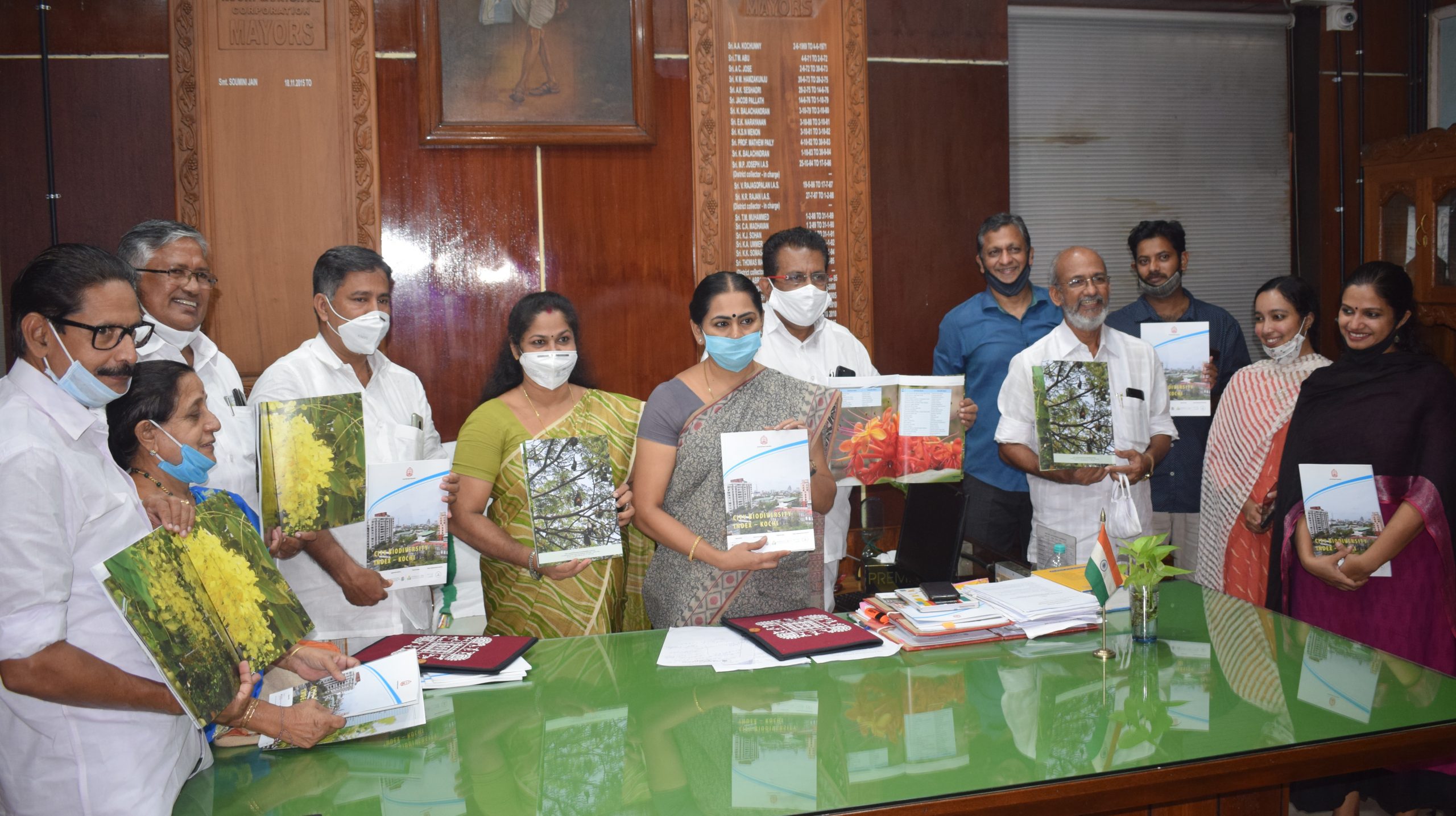
The City Biodiversity Index and Illustrated Natural Asset Map of Kochi Municipal Corporation, prepared under INTERACT- Bio project was released by Hon’ble Mayor Soumini Jain. Kochi is one the very few cities in India who have developed the City Biodiversity Index. The City Biodiversity Index of Kochi has been developed with support from ICLEI-Local
- C-HED wins HUDCO Award
The Centre for Heritage, Environment and Development (C-HED) of the Kochi Corporation has been adjudged winner of the innovative model for ‘urban governance’ instituted by the Union government’s Housing and Urban Development Corporation for recognising best practices to improve living environment. The award for the 2019-20 fiscal was declared at a function held in
- NIUA Newsletter – Issue 5
Read on :https://drive.google.com/file/d/1rU5s7FWdxNR33I2Mwxo1oloSTKV7ziyJ/view?usp=sharing
- EnteKochi Urban Design Competition
Kochi Municipal Corporation (KMC), with the support and cooperation of GIZ India, under the “Sustainable Urban Development – Smart Cities” (SUD-SC) project, has launched the ‘EnteKochi-Competition’ – a novel approach to a national-level ‘Urban Design Competition’ (UDC), that aims to jointly ‘design the future city’ of Kochi. Multi-disciplinary teams of professionals from diverse backgrounds (Social
- Kochi Metropolitan Web Lab
As part of the India-EU Urban Partnership (IEUP) programme a Kochi Metropolitan Web Lab was organised by the Centre for Heritage, Environment and Development. Inaugurated by the Hon’ble Mayor, the web lab focused on ‘Resilient Urban Planning’ (given its significance post COVID and resulting issues such as reverse migration). The two week long brainstorming session
- Standard Operating Procedures for Bus Transport – Post COVID-19 Lockdown
“Standard Operating Procedures for Bus Transport – Post COVID-19 Lockdown” prepared as a part of Integrated and sustainable urban transport systems in smart cities (SMART-SUT), by GIZ India. Read on : Standard Operating Procedures for Bus Transport – Post COVID-19 Lockdown
- Stakeholder Consultation Workshop – Urban Community Resilience Assessment
As a part of Cities 4 forests initiative by World Resource Institute (WRI India) a multi-stakeholder consultation workshop to assess the indicators of the Urban Community Resilience Assessment (UCRA) tool for Kochi was conducted at c-hed. The workshop was to identify the scope to apply the UCRA Tool in the vulnerable neighborhoods of Kochi city. Stakeholders
- Green Corridor Project (N-S Corridor)
Mobilise Your City (MYC) project, an initiative of the Union Government to reduce Green House Gas (GHG) emissions related to urban transport. Kochi is one of the cities selected for the MYC project. Urban Mass Transport Company (UMTC) has been entrusted with the task of implementing the project in Kochi. Under the MYC programme, the
- C-HED at 10th World Urban Forum
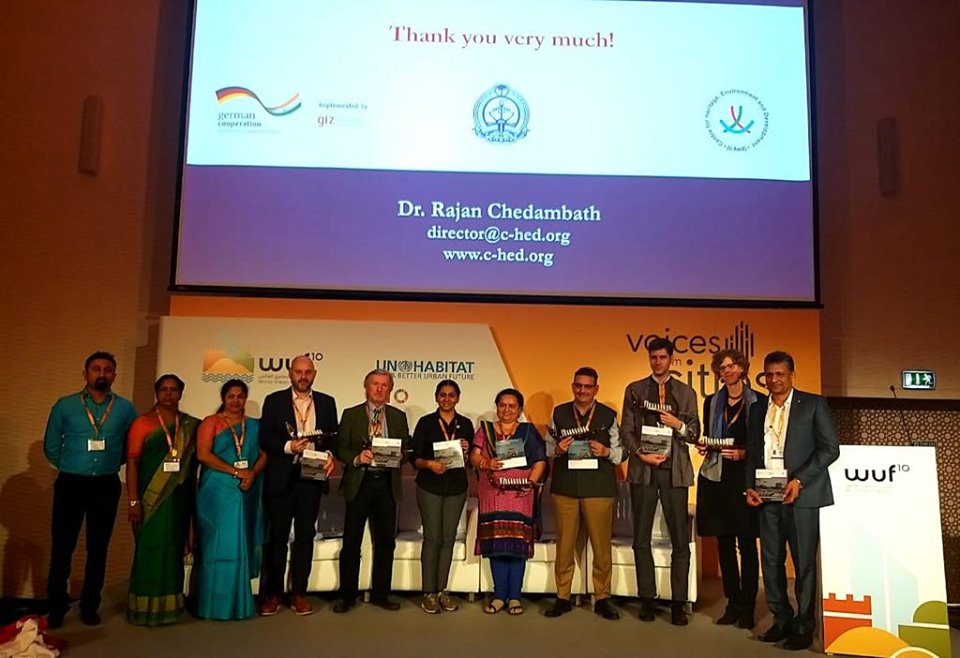
Centre for Heritage, Environment and Development (C-HED) director Dr. Rajan Chedambath presented our organisations case at the 10th World Urban Forum in Abu Dhabi, UAE. This competition is designed to share and exchange valuable knowledge and experiences between cities all around the world, with C-HED representing Kochi this year. Joining Dr. Rajan on stage and
- Water Conservation Workshop
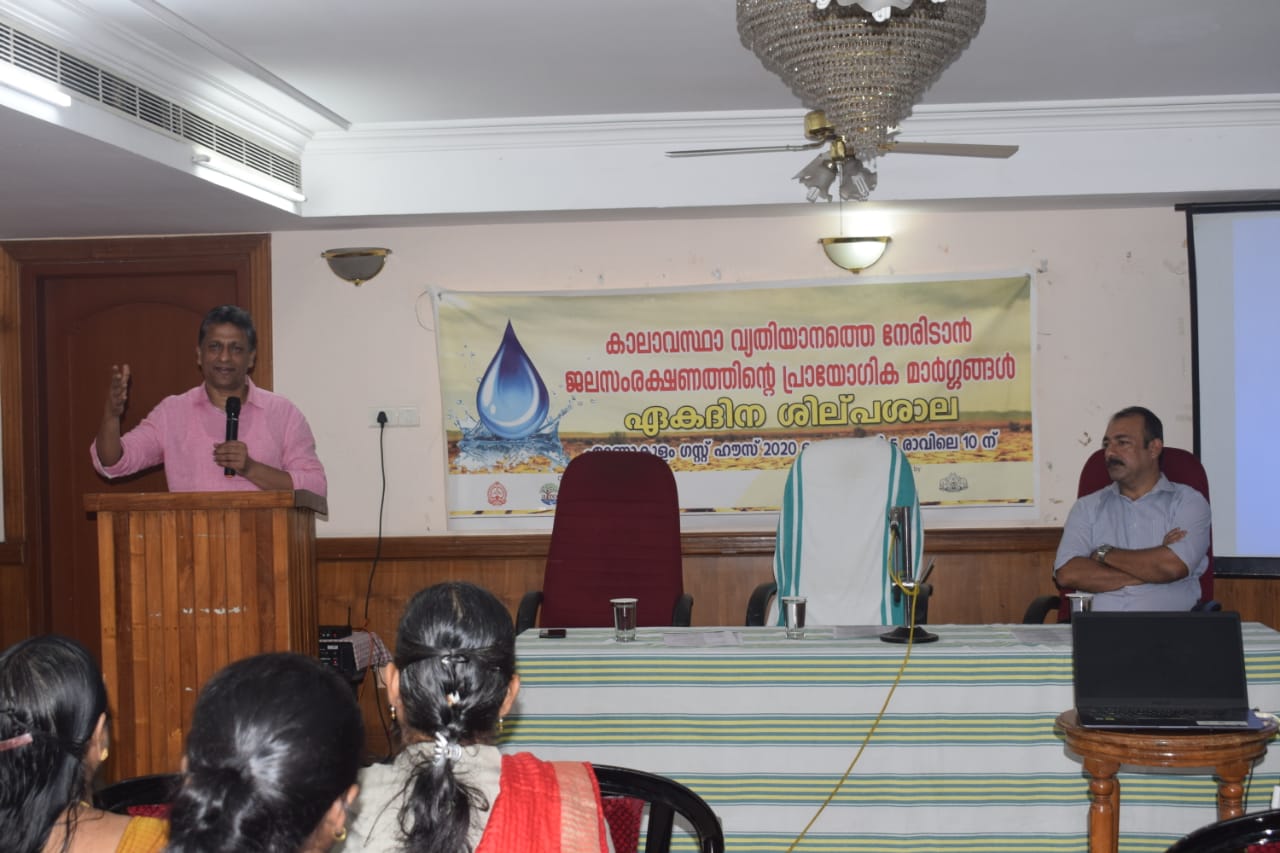
The Centre for Heritage, Environment and Development (c-hed) and Ashoka Trust for Reserarch in Ecology and Environment (ATREE), organised a 1 day workshop where we discussed and deliberated on measures for water conservation including developing awareness and strategies to help fight climate change. The event was supported by the Kochi Municipal Corporation and Department of
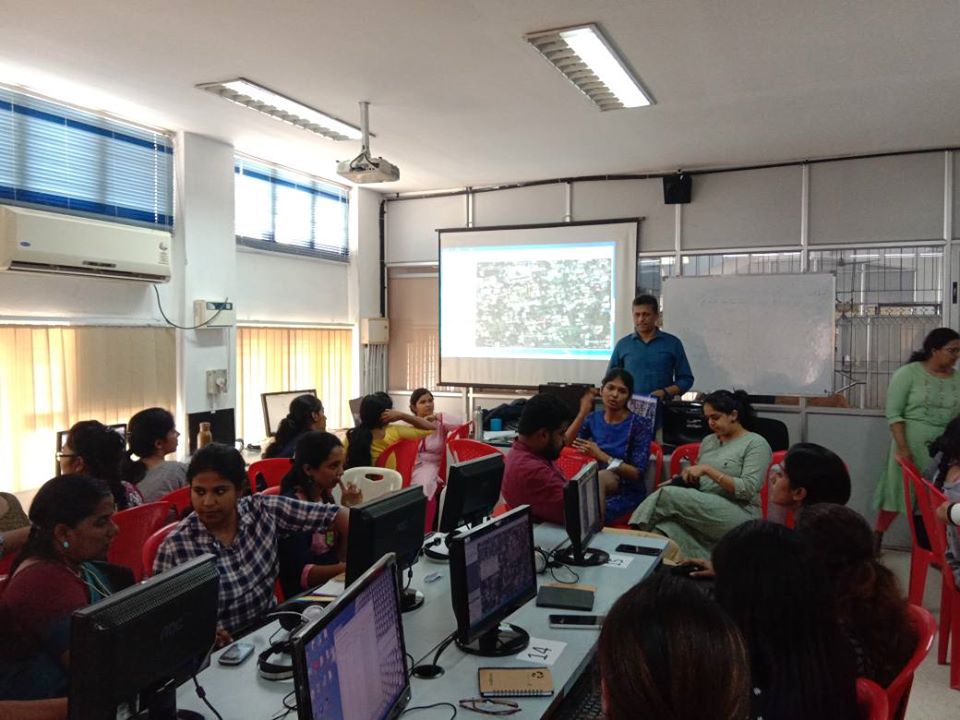
- Mapathon – Cities4forests
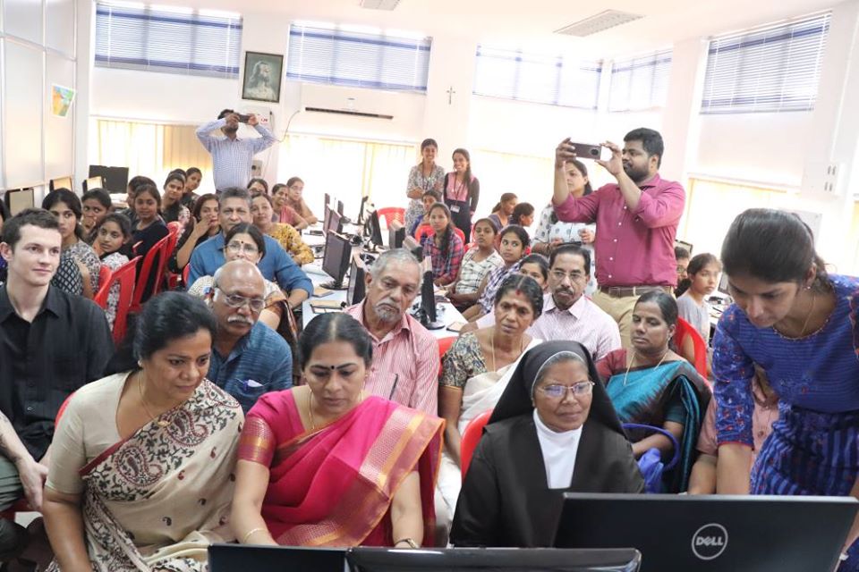
The Kochi Municipal Corporation in association with the World Resources Institute India organized a ‘Mapathon’ in coordination with the Centre for Heritage, Environment and Development, as part of the Cities4Forests project from 9 to 11 January, 2020 at St. Teresa’s College, Kochi to develop monitoring mechanism in Kochi and enhance community participation in restoration. Kochi
- Summer-Winter-School , CEPT University, Ahmedabad
The Summer Winter School Program of The Premier Habitat University of India , CEPT for 2019 begins in Kochi. This year the program focuses on Smart and Sustainable Urban Development – Experiences from Kochi, India and Frankfurt, Germany with more than 26 CEPT university Masters students and Town planning officials participating in the same. The week
- Training Workshop – MYC
The Kochi Municipal Corporation in partnership with French Development Agency (AFD) and GIZ, organized two day training workshop on sustainable and low carbon urban mobility in association with MYC and SMART-SUT, on 25th and 26th July 2019. On behalf of Kochi Municipal Corporation, the Centre for Heritage Environment and Development (c-hed) supported the organization of
- Climate Smart Cities
Ministry of Housing and Urban Affairs, Government of India is implementing a project named ‘Climate Smart Cities’ in Kochi city which is commissioned by Federal Ministry for the Environment, Nature Conservation, and Nuclear Safety (BMU). The project is implemented by GIZ. The project is aimed to develop climate-friendly solutions for urban infrastructure projects and area-based
- Capacity building program – Ecologistics
A two day capacity building workshop on sustainable urban freight management in Kochi in association with ICLEI South Asia and Kochi Metro Rail Limited, on 7th and 8th June 2019. The focus of the capacity-building workshop was to prioritize strategies that promote goods transportation with minimal impacts on air quality, noise, health and fatalities and
- A tree for a child
The Kochi Municipal Corporation is implementing a programme named ‘A tree for a child’, as part of its environment conservation initiatives for the city. The initiative aims at increasing the number of trees per person in the city. As per the programme, the parents of a new born in the city can plant and nurture
- Visit of official delegation from Vilnius , Lithuania as part of IUC programme
As part of the International Urban Cooperation Program funded by the European Union, a five member delegation from Vilnius, Lithuania led by the head of the urban development department, Mr. Mindaugas Pakalnis, visited Kochi to meet various stakeholders within Kochi Municipal Corporation, Kochi Smart City and other parastatal agencies involved in various urban development related activities in
- Subhash Park Tree Naming and Handbook Release
The Subhash Bose park which is maintained by the Center for Heritage, Environment and Development is rich in biodiversity. Under the interact bio project, jointly conducted by Kochi Municipal Corporation, c-hed and ICLEI, Mapping, Identification and Naming of trees in Subhash Bose Park were done. A total of 434 trees were identified which included 61
- Chullickal – Energy Survey
The Kochi Solar City Cell has launched an energy survey at Chullickal division of the Kochi Municipal Corporation. The survey kick started on 24/1/2019 with the support and help of 30 students from the Department of Commerce, Cochin College. The survey aims to identify the possibility of installing solar panels at residential buildings, finding the energy
- DRAWING WORKSHOP 2018
The CEPT University is conducting a drawing workshop “The sudden change of the line” as part of their winter school 2018 program. The workshop started on December 17th 2018 and has 19 students from various streams participating. The program is known for its distinctive spirit provides a dynamic and multicultural learning experience where the students
- POSTER DESIGNING COMPETITION
The Ministry of New and Renewable Energy (MNRE), Government of India had launched a scheme on “Development of Solar Cities”. Under this scheme Kochi was selected as one among the 60 cities to be supported for development as “Solar/ Green Cities”. The council of the Kochi Municipal Corporation had assigned the Centre for Heritage, Environment
- International Urban Cooperation Project
Funded by the European Union, the International Urban Cooperation (IUC) programme activities will support the achievement of bilateral policy objectives as well as major international agreements on urban development and climate change, such as the Urban Agenda, the Sustainable Development Goals, and the Paris Agreement. The IUC programme will engage with major international financial institutions and
- URBAN PATHWAYS
URBAN PATHWAYS The Urban Pathways project helps delivering on the Paris Agreement and the NDCs in the context of the New Urban Agenda and the Sustainable Development Goals. It has established a facility in close cooperation with other organisations and networks active in this area to support national and local governments to develop action plans
- One Planet City Challenge 2018-19
In cities, everything is closely connected. As cities and urban populations expand across the globe, the problems in cities also tend to multiply. Cities generate over 70% of global carbon dioxide emissions, while also providing a space for urgent (and tangible) climate action. The good news is that solutions can also multiply. And fortunately, solutions already exist today
- Fort Kochi Visioning Workshop
Fort Kochi is known as the cradle of Eurasian culture. It has a history of more than 500 years with an influence of both Indian and international cultures. Its vibrant history and culture makes it one of India’s major tourist hotspot. It has also been included under Kochi Smart City Project. WRI India in collaboration with Kochi Municipal Corporation ,Cochin Smart
- Kick-off workshop to road map for Zero Carbon Buildings for Kochi city
The Kochi Municipal Corporation (KMC) had, in its Annual Budget 2018-19, announced a rather innovative project “Zero Carbon Buildings” , which it intends to implement by associating with World Resources Institute India (WRI India) to develop a roadmap and action plan for all buildings to achieve zero carbon potential for Kochi city. Kochi is both a solar city and smart city and
- INTERACT Bio
INTRODUCTION: The project aims to strengthen the integration of biodiversity management at all levels of governance and facilitate cooperation between national and sub-national authorities for ecosystem management in urban regions. It is funded by Federal Ministry for the Environment, Nature Conservation, Building and Nuclear Safety (BMUB) under their International Climate Initiative (IKI). The project is
- Maintenance and Management of Subash Chandra Bose Park
The Subhash Bose Park sandwiched between Park Avenue and the Ernakulam backwaters and facing the harbour is the most scenic and tranquil public space in the city. As the city chokes with ever-growing traffic and congested living conditions, this park has become the green lung and breathing space for the citizens of Kochi. It is
- National Workshop on ‘Guidelines for Biodiversity Conservation for Cities’
A national workshop was held as part of the activities under the INTERACT-Bio project (German-funded urban biodiversity project) that aims at supporting selected cities in India, Brazil and Tanzania to sustainably manage biodiversity and ecosystems, and support local governments. The national workshop on ‘Guidelines for Biodiversity Conservation for Cities’ was organised by the Kochi Municipal
- Dedicating Sculpture Ensemble to the City
The renovated sculptures in the Subash Chandra Bose Park, was dedicated to the city on 6th of February 2018 by Artist Namboodiri and literary critic Prof. M.K. Sanoo who were the Guest of Honors for the evening. The renovated work was unveiled in the presence of Hon’ble Mayor Smt. Soumini Jain, Kochi Municipal Corporation Chairpersons
- Sculpture Restoration Camp
The Subhash Bose Park lying on the banks of the Ernakulam backwaters and facing the harbour is the most scenic, tranquil and highly frequented public space in the city. As the city chokes with ever-growing traffic and congested living conditions, this park has become the green lung and breathing space for the citizens. The park
- Kick-Off Workshop on low-carbon urban energy, mobility and waste management solutions
The city of Kochi has been invited to be part of new initiative – the Urban Pathways project that aims at action delivering on the New Urban Agenda in the context of the Paris Agreement by the UN Habitat. This is in continuation with the SOLUTIONs project (Sharing Opportunities for Low carbon Urban TransportationS) in which Kochi
- Consultative Stakeholder meeting on Air Quality Solution for Kochi
Poor air quality is the largest environmental risk to public health in the India and investing in cleaner air and doing even more to tackle air pollution are important priorities. In order to bring air quality solutions to Kochi and tackle the growing problem of air pollution, the Centre for Heritage, Environment and Development (c-hed)
- c-hed signs MoU with CSL
As part of the maintenance and management plan of the Subhash Bose Park, c-hed had prepared a major restoration plan for the sculptures in the park. Though the proposal was submitted to three different organizations for the CSR fund support, it was the Cochin Shipyard ltd, who came forward to support the project. The Centre
- Interact BIO – Stakeholders Consultation
As part of the German funded INTERACT- Bio project a Stakeholder Workshop was organised with support of Kochi Municipal Corporation and Centre for Heritage, Environment and Development, and facilitated by ICLEI- South Asia. The project aims to mainstream and integrate biodiversity conservation and management into the planning process at the national, subnational and local level. Funded by
- Stakeholders Meeting on Action Plan for Solar City Project
Kochi city has been identified as a solar city by Ministry of New & Renewable Energy (MNRE), Government of India and was assigned to prepare a solar city master plan for the city. Kochi Municipal Corporation (KMC) had engaged empanelled consultants of Ministry ofNew & Renewable Energy (MNRE) to prepare this master plan. The preparation
- SOLAR CITY CELL
Kochi was one of the 60 cities that were picked up for implementing the Solar city programme initiated by the Ministry of New and Renewable Energy, which “aimed at creating self-sustaining cities by leveraging the immense solar potential through renewable energy and several other energy efficiency projects. The programme also aims at “curbing conventional energy
- Subhash Bose Park
Subhash Bose Park is one of the most frequented public spaces in Kochi. Park was affected in a major way with the new malls that rose in the city. With poor maintenance and lack of upkeep, the Park was finding it difficult to attract crowd. It is in this regard that a major facelift work
- Meeting with Hon’ble Ambassador of Belgium H.E Mr. Jan Luykx
A trade mission from Belgium led by Ambassador Jan Luykx and Consul-General Bart De Groof has offered technology solutions and ideas for the Kochi Smart City programme. During a joint session organised by the Belgium Embassy in India, Brussels Invest and Export, Kochi Municipal Corporation and Cochin Smart Mission Ltd on Monday, presentations and B2B
- Asian Cities Climate Change Resilience Network (ACCCRN)
The Centre for Heritage, Environment and Development in association with the ICLEI Local Government for Sustainability, South Asia organized a one day Shared Learning Dialogue (SLD) workshop as a part of the Asian Cities Climate Change Resilience Network (ACCCRN), in Kochi on 17th June, 2016. ACCCRN is an initiative supported by the Rockefeller Foundation, to strengthen
- Visit of UN-Habitat Official
As part of the SOLUTIONS project, UN-Habitat Urban Basic Services Branch Urban Mobility Unitse Sustainable Urban Mobility Specialist Ms. Stefanie Holzwarth visited Cochin and met Mayor Soumini Jain and Dr. Rajan Chedambath, Director , Centre for Heritage, Environment and Development to discuss on the various transportation initiatives of Cochin and to know more on UMTA and
- Water Policy for Kochi
The city of Kochi is facing unique water related problems like continued increase in population due to urbanization and industrialization which is causing severe decline in the quality and quantity of water. It is against this background that the budget of the Kochi Municipal Corporation for the year 2014-2015 decided to have a local water
- Principals from Cochin visit Sweden
As part of the ongoing Cochin-Kumla School Atlas Programme, the Principals of the selected schools Bhavan’s Girinagar and St. Teresa’s CGLPS School visited Kumla on August 24th, 2015. The programme initiated by the Centre for Heritage, Environment and Development and ICLD ( International Centre for Local Democracy) aimed at discussing ecological balance, environmental protection and socio-cultural exchange
- Steel cutting for RO-RO vessels
The ‘steel cutting’ for the two roll-on-roll-off vessels of the Kochi Municipal Corporation was held on August 1 at 11 a.m. at the Cochin Shipyard. The two vessels, which can carry passengers as well as cars and trucks, have been named as RY 96 and RY 97. Prof. K.V. Thomas, MP cut the steel for
- City Water Audit for Kochi
The city of Kochi is one of the fastest-growing urban centers in the country and is the commercial capital of Kerala. With 74 wards, the Municipal Corporation is the most densely populated one in the state and faces many challenges in the water sector, ranging from inadequate water distribution network, depleting groundwater quantity and quality
- Relaunch of the works of the new Corporation Office Buliding
After a rift of over 8 years, the Kochi Municipal Corporation re-launched the construction works of the new Corporation office building at Marine Drive. The excise, fisheries, port Minister Shri. K Babu inaugurated the re-launch function on 16th July 2015. The entire construction work of the building will be completed in 18 months. It was
- Water Quality Analysis
The Kochi Municipal Corporation had conducted a water quality analysis as part of the Water Policy project for the City. The analysis was carried out by the Water Institute of the SCMS College. Presence of coliform bacteria, nitrate and iron was detected in the drinking water in the analysis. The contact of sewage water directly with
- Kochi – A WiFi City
The Kochi city is now WiFi enabled.The Kochi Municipal Corporation along with BSNL and Quadgen Wireless Solutions has launched 10 free WiFi hot spots locations in the city.The 10 locations are Kochi Municipal Corporation Office, Subhash Park, Marine Drive, District Court Complex, High Court, Durbar Hall ground, Edapally Junction, Kaloor Bus stand, Mattanchery and Fort
- Kochi Night Life Zone
The city’s dream of nightlife will take wings soon by the Kochi Municipal Corporation’s new project for proposing nightlife zones in Broadway, Subhash Park, Marine Drive, Foreshore Road, Durbar Hall and Park Avenue in cooperation with GCDA and District administration. These selected zones will be equipped with mobile food kiosks, promote socio-cultural activities, shopping facilities etc. With
- Broadway Makeover – MoU Signed with Kerala Merchants Chamber of Commerce
The Kochi Municipal Corporation and Kerala Merchants Chamber of Commerce signed a Memorandum of Association (MoU) for the maintenance and beautification of Broadway, one of the oldest and busiest trade centres in the city. As per the project, the Broadway will be spruced up with 52 ornamental lamp posts with lamp shades starting from Shanmugham
- Kochi to be a Solar City soon!!!
The Master Plan for the Kochi Solar City project is ready which help the City to become the first energy efficient City in Kerala. The copy of the master plan was collected from the Deputy Director of International Council for Local Environmental Initiatives (ICLEI) Shri. Sunandan Tiwari by the Hon’ble Mayor Shri.Tony Chammany at a
- Clean Destination campaign
As part of the Visit Kerala campaign of the Tourism Department, the Kochi Municipal Corporation, District Administration in association with the Kerala Travel Mart Society launched the Clean Destination project, aimed at making all tourist destinations clean and free of waste. The first phase of the project was commenced at Vasco da Gama square in
- Animal Birth Control – Anti Rabies Vaccination Programme
The Kochi Municipal Corporation launched the ambitious project ABC-ARV programme of Mission Kochi 15-8-15 to resolve the perennial issues of street dogs in the city by constructing a high-tech multispeciality veterinary hospital at Brahmapuram spending around 1.20 crores, which was inaugurated by the Minister of Urban Affairs Shri. Manjalamkuzhi Ali on May 28th, 2015. The
- Peace Boat spreads message of nuclear-free world
The Kochi Municipal Corporation along with Mayors for Peace, an international organization working for global peace accorded a warm reception to the peace boat arrived in Kochi carrying survivors of the atomic bombings at Hiroshima and Nagasaki (Hibakushas) in Japan. This was the 87th global voyage of the ship. During the reception, a commemoration ceremony
- Inauguration of the Renovated Ernakulam Town Hall
One of the major landmarks of the city, the Ernakulam Town Hall was renovated and re-opened by the Hon’ble Chief Minister of Kerala, which was given a face-lift spending around Rs 2.7 crores. Care was taken to retain the heritage structure while renovating the building, which has been hosting public functions since 1961. The old
- Workshop on Sustainable Transport Solutions for Cochin – March 25-27, 2015
Held during 25 to 27 March 2015, Kochi, India, the three day workshop on sustainable transport solutions workshop gathered various stakeholders regarding urban transport in the city and international expert organizations to discuss on possible solutions that can resolve the overwhelmed transport demand. Kochi has been selected as one of the take up city under
- Agreement Signing Ceremony for Building Ro-Ro (Roll-On Roll-Off) Vessels
The Kochi Municipal Corporation had inked an agreement with the Cochin Shipyard Limited to design and develop two modern and technically advanced Ro-Ro vessels for ferrying both people and vehicles to and fro from the mainland – Fort Kochi – Vypeen island. This vessels will have double entries which will decrease the total time of
- Kochi Municipal Corporation – Annual Budget 2015-2016
The Kochi Municipal Corporation Fifth Annual Budget 2015-16 was presented by the Deputy Mayor of the city Smt. Bhadra on March 23rd, 2015. This year’s budget focused solely on the execution of the existing projects and proposals. The budget emphasizes the improvement of transportation sector through pothole free roads, interlocking tiles at major junctions, modern
- Mosques of Cochin
The world famous Architect Smt. Patricia Fels in association with c-hed had made a detailed study about the vernacular mosques in Cochin and published the same as a book named “Mosques of Cochin” in association with Mapin Publication. Mosques of Cochin is an invaluable contribution the documents the surviving vernacular mosques, which stand as powerful
- Solar City Draft Master Plan
The draft master plan of the Solar City project for the Cochin City prepared by International Council for Local Environmental Initiatives (ICLEI) was presented before various stakeholders by Ashish Verma, Manager (Energy and Climate) of the Institute. The goal behind the project is to reduce at least 10 percent of the projected total demand of conventional
- One Kochi One Colour
After the successful completion of the Mission Clean Kochi Campaign, the Kochi Municipal Corporation has jumped to an advanced second phase with the plan to paint the city blue to ensure a unique identity for the city through the campaign called ‘One Kochi, One Colour’. As part of the project, the walls of buildings, especially
- Visit of Councillors from Vadodara Municipal Corporation to Kochi Municipal Corporation
A 40 member team of councillors from the Vadodara Municipal Corporation visited the Kochi Municipal Corporation to understand and learn about the city’s achievements. The team visited Kochi Municipal Corporation as they were attracted by the Corporation’s achievements in solid waste management. Sewage treatment, drainage, protection of heritage areas and E-governance were also discussed during the
- Visit of Japanese Delegation to Cochin
A 40 member Japanese delegation including the Mayors of five cities visited the Kochi Municipal Corporation and evinced great interest in helping the Cochin City in sewage treatment, water – disaster management and environmental issues. The 40 member Japanese delegation also included the members of Lake Nakaumi, Lake Shinji and Mt. Daisen Area Economic Council
- Students Council
The Kochi Municipal Corporation had organized Students Council as part of the Childrens Day Celebrations of 2014.Cleanliness was the main agenda of the council. The student council was being held after a gap of 20 years. Sanal Simon, a 10th class student of Assisi Vidyaniketan School, Chembumukku took the role of the Mayor and administered
- Inauguration of Mission Kochi 15-8-15
The Hon’ble Chief Minister of Kerala inaugurated the Mission Kochi 15-8-15 campaign of Kochi Municipal Corporation on 25th August 2014. The new waste collection compact vehicles of the Kochi Municipal Corporation was also flagged off during the function. Public Works Minister V K Ibrahim Kunju handed over the letter of permission to the Clean Kerala
- 2nd Indo – German Water Partnership Summit, 2014
The 2nd Indo-German Water Partnership (GWP) Summit was organized by c-hed for Kochi Municipal Corporation in association with SCMS Group of Educational Institutions. The event was inaugurated by the Hon’ble Chief Minister of Kerala Shri. Oomen Chandy on 6th October 2014 at Cochin. The one-day conference involved panel discussions on industry-academia partnership on solving water
- Technical Workshop on Environmental Impact Assessment (EIA)
A two day technical workshop on Environmental Impact Assessment was organized by the Kochi Municipal Corporation in association with SCMS College of Engineering and Technology on February 21st and 22nd, 2014. The technical workshop was inaugurated by the Hon’ble Mayor of Cochin Shri. Tony Chammany. The Technical workshop on Environmental Impact Assessment (EIA) was an eye
- Kochi Municipal Corporation – Annual Budget 2014-2015
The Fourth Annual Budget of the Kochi Municipal Corporation, led by the Hon’ble Mayor of Cochin Shri Tony Chammany, was presented by the Deputy Mayor of the city Smt. Bhadra on February 17th, 2014. The 8,57,75,31,849 rupees budget aims at the overall development of the city with growth in every sector. This years budget emphasizes
- Inauguration of Vanitha Jagratha Samithi and Launch of ‘Help Me on Mobile’ application
In a bid to make Cochin as a women-friendly city, the Vanitha Jagratha Samithi mooted by the Kerala Women’s Commission in the Kochi Municipal Corporation limits was launched on December 2nd, 2013 in EMS Town Hall. The Union Minister of State for Food and Civil Supplies, Shri K V Thomas inaugurated the function and also launched
- AsianCitiesAdapt : Learning Exchange
Twenty cities from all around South Asia came together in Cochin on October 30th, 2013 to learn from each other on the issue of adaptation to climate change at the AsianCitiesAdapt: Learning Exchange, co-organized by Kochi Municipal Corporation and ICLEI South Asia. The workshop, that took place on 30th-31st October 2013, gathered an impressive line-up
- Visit of School Delegation from KUMLA as a part of School Atlas Program
As a part of the Municipal Partnership Program between the city of Cochin and city of Kumla (Sweden), a group of four member School Delegation from the Municipality of Kumla, Sweden visited the schools in the city. The Swedish delegation, consisting of teachers Lena Brostroem, Petra Eriksson, Joakim Gillman and Kumla City International Coordinator Ted
- MOBILITY GRID WORKSHOP – Joining the Dots….
The city of Cochin is witnessing the great shift towards a metro city with its infrastructure boom and transport projects. With the commencement of many major projects, the focus has shifted to providing seamless and sustainable accessibility and connectivity through integration of transport systems. The challenge lies in understanding the opportunities and constraints and visualizing the
- Visit of Official Delegation from the City of Kumla (Sweden) as part of the Municipal Partnership Programme
The city of Cochin and the city of Kumla(Sweden), has entered into a long-term self-sustaining relation through Municipal Partnership Program, as a result of the match making conference held in the city organized by ICLD, Swedish International Center for Local Democracy and Swedish Embassy. The city of Cochin had signed a memorandum of understanding with
- A Joint Session towards State of the Art Review for the Development of Operations Document for UMTA and UTF for Cochin
With an aim to implement key urban transport reforms envisioned in the National Urban Transport Policy (NUTP) the Ministry of Urban Development (MoUD), Government of India has initiated the Sustainable Urban Transport Project (SUTP) that aims at facilitating the provision of the urban transport infrastructure and services. In this context, the experts delegated by the
- Cochin-Lorient Partnership Programme on Development and Urban Heritage Conservation
The city of Cochin and the city of Lorient have entered into a Bilateral Agreement during Emerging Kerala 2012, hosted by the Government of Kerala. Ever since both the cities have been working together to formulate methodologies to take this joint projet forward. As a part of this Joint Cooperation Programme a Technical Workshop was
- ANNUAL BUDGET 2013-2014 of the Kochi Municipal Corporation
The Third Annual Budget of the Kochi Municipal Corporation, led by the Hon’ble Mayor of Cochin Shri Tony Chammany, was presented by the Deputy Mayor of the city Smt. Bhadra on March 23rd 2013. This year’s budget has been formulated so as to cater to the needs of the city as a developing metro.
- Broadway Urban Renewal, Ernakulam Market Urban Renewal and Renewal of Pond and Waterways to the Pond
One of the most important projects carried out by the c-hed is the preparation of the Detailed Project Report (DPR) of the above mentioned Broadway and Ernakulam Market Heritage Urban Renewal Project. The c-hed had been entrusted with the task of preparing the DPR of the above project by the Kochi Municipal Corporation. With the
- Master Plan preparation of Cochin City
Under the c-hed’s initiative a national workshop on formulation of vision document and strategic plan for Cochin City with a vision period of 20 years was organized in the year 2003. The recommendations of this seminar were the basis of the Vision Document prepared for Cochin City. On the basis of this vision document the
- JnNURM Projects
Jawaharlal Nehru National Urban Renewal Mission – JnNURM A massive city-modernization scheme launched by the Govt. Of India under the Ministry of Urban development, JnNURM, aims to improve the quality of life and infrastructure in the cities. This mission hugely relates to the development of the cities, aiming at creating economically productive, efficient, equitable and
- Conservation and Development Plan – for the Heritage Zone of Fort Cochin and Mattanchery
This is one of the biggest heritage conservation projects conceived to protect the rich cultural and natural heritage of Fort Cochin and Mattanchery. The project was initiated by the c-hed and the UNESCO has given full support and assistance in the preparation of DPR for the above and the implementation of the same. The experts
- Cochin City Heritage Base Map
The city of Cochin, well known for its rich heritage and pluralistic culture, has been influenced by various cultures and nationalities, leaving their impressions in the fields of architecture, arts, crafts, cultural and heritage institutions. Tracking and documenting of heritage footprints of a city is an important task. Documentation and listing done in this regard is of great significance
- Management of Cultural Institutions
Cochin has a spectacular heritage of cultural expressions across many art forms and customs. The city has a secular, multicultural and diverse community. Amidst all major developments, the need for preserving, promoting and propagating the rich culture, tradition and heritage of the city is necessary. The role played by cultural institutions in this regard is
- Digitilization of Classrooms – Smart Class Room
We are living in an age of technology where technological advances are necessary for students, teachers and schools to compete with the developed countries. With an aim to reap the maximum benefits of modern technological advancements, the city administration decided to include the Project ” Smart Classroom” in its budget for the year 2012-2013. The c-hed had prepared
- Disposal of used Sanitary Napkins in schools
The proper and safe method of disposal of used sanitary napkins has been a major hurdle faced by city administrations the world over. Used sanitary feminine napkins are usually considered as residual waste, that is not compostable or recyclable and, therefore goes to dump-sites and landfills. It plays a major role in the clogging of
- Project for Evolving a System for Managing Plastic Waste in the City of Cochin
The popularity of plastic bags has led to a dramatic increase in the amount of bags found dumped in open grounds or water bodies. Apart from dumping, another method of disposal of plastics currently in vogue in the city is burning in open heaps which releases harmful dioxins into the atmosphere. The KochiMunicipal Corporation has
- Management of Libraries under the Kochi Municipal Corporation
The only true equalizers in the world are books; the only treasure-house open to all comers is a library; the only wealth which will not decay is knowledge; the only jewel which you carry beyond the grave is wisdom. – J.A. Langford Libraries are heaven for students, teachers and simply to all those who
- Climate Change
The climate is changing and the earth is warming up. Significant and lasting statistical change in distribution of weather patterns have been noticed and these changes in large are found to originate from human activities. Climate change has been recognized as a major concern for countries throughout the world, for both industrialized and developing. c-hed
- Integrated Conservation and Development of Ernakulam Heritage Zone – Central Area
This is one of the principal projects that the c-hed had undertaken to conserve and develop the Ernakulam Heritage Zone which is the heart of today’s City of Cochin. Most work places such as administrative and institutional centre and market places are located here. It is the central spine, identified as an area of intense
- Quality of Water and Ground Water Level
With a rise in population the demand for water is ever increasing. The ground water resources play an important role in meeting the drinking water purpose of a large populace. But these resources needs to be managed judiciously in order to ensure adequate supplies of dependable quantity, quality of ground water. Reduction in rainfall and
- Impact of Development on Backwaters
The costs of Kerala is bordered by 29 – backwaters running parallel to the shoreline. The water quality of these backwaters is deteriorating due to population explosion, rapid urbanization, industrialization, silting and agricultural activities. The city of Cochin has a good network of inland waterway system consisting of backwaters, canals and chain of lagoons. National
- Study on Soil Erosion and Deposition
A leading seaport since the 14th century, Cochin is the coastal city of Kerala with multi-cultural population. Being a dynamic coastal region, city’s coastal area is prone to erosion and deposition at different locations. Many studies indicate that a major stretch of Kerala’s coast line is eroding. The coastal areas of this city are experiencing
- Dutch-Cochin Project formulation
The commercial capital of Kerala and the cosmopolitan city of Kerala, Cochin is a mesmerizing blend of cultures. It has been the most sort after destination by sea-farmers and traders who later on settled on this enchanting land. Blessed with one of the finest natural harbors, the city of Cochin is rightly called ” The
- Built Heritage Conservation Projects
The city of Cochin revels in being a metropolitan where diverse cultures coexist without tampering the rich history of the city. Fort Cochin and Mattanchery are historic towns brimming with tales of myriad seafaring visitors from around the world who arrived here for trade and eventually settled down on these charming lands. It is home to many
- An Academic Session with students from Georgia University
The c-hed, an academic institution is into collaborations and exchange programmes with many notable national and international universities. The association with various universities and institutes across the world has led to collaborative research, academic support in terms of courses, seminars and developing academic programmes. Such partnerships has been facilitating the exchange of ideas and exposure to new experiences and
- Project on the “Impact of Plastic Debris on Marine and Human Health”
Plastic pollution in marine eco-system has been causing health hazards and economic loss. This non-biodegradable haphazard is one of the major threats to the very existence of mankind on this planet. The presence of plastic pollutants in the sea and backwaters of Cochin has been upsetting the marine eco-sytem and breeding grounds of a large
- Special Session towards Formation of Unified Metropolitan Transport Authority (UMTA) for the City of Cochin
Though the rapid urbanization over the years has increased the number of roads, the unorganized parking, congested junctions are all causing havoc’s to the smooth flow of traffic within the city. Public transport systems have not been able to keep pace with the rapid increase in demand over the past few decades. Bus services in
- Road Conclave
The City of Cochin widely known as the commercial and economic capital of the state of Kerala, has been facing serious problems with regard to maintenance of its roads. The present road infrastructure hasn’t been able to meet the growing traffic demands and hence traffic congestion is becoming a major problem for the city. In
- Special Session towards Formation of Unified Metropolitan Transport Authority (UMTA) for the City of Cochin
Though the rapid urbanization over the years has increased the number of roads, the unorganized parking, congested junctions are all causing havocs to the smooth flow of traffic. The c-hed had initiated this special session towards formation of Unified Metropolitan Transport Authority, which was attended by Hon’ble Minister Sri. K. Babu -Minister for Fisheries, Ports
- Training Programmes for Students from National & International Universities
The c-hed has been associating with various national and international universities over the years in imparting training to students on various subjects and providing an insight into the development and planning activities of the city of Cochin. The c-hed is into collaborations and exchange programmes with many notable academic institutions. The association with various universities and institutes across
- Students Interaction & Training Programmes on Culture and Heritage
Students are the future of a nation. The role that they play in developing a nation is huge. They are the greatest power house of information and our asset for the future. The ill-effects of globalization has led to neglect and lack of interest in Heritage among student community. One must remember that what is
- Environmental Master Trainers
The c-hed had taken the lead in initiating a programme for training over 300 students from 7 different colleges in solid waste management and spreading environmental awareness. The student who successfully completed this training were awarded the title “Environment Master Trainers”, who in turn provide training in scientific systems of waste management to other students
- South Indian Summer River Camp
Rivers are important from hydrological, economic and ecological point of view. They are the very system that support the people and environment that survive on it. The river basins across globe are facing major environmental problems and the threats are mounting as days pass by. Deforestation, for urban, industrial and agricultural use; Pollution from agricultural
- Heritage Forum
The c-hed in association with the District Education Office, Ernakulam launched the school heritage forum at the SN Higher Secondary School, Thrikkanarvattom on August 18th, 2004. The heritage forum is intended to familiarize school children with the rich culture and heritage of the land and introduce them to the concepts of preservation, conservation and management
- Bharath Fest
The city of Cochin is a land of cultural ethnicity and diversity. From time immemorial, this land has attracted traders and seafarers who made Cochin their home. Today it has the most diversified society with Gujarathi, Marathi, Konkani, Bengali, Kannada, Tulu, Jewish etc. contributing substantially to Cochin’s cultural growth. Each of these traditions preserved their
- World Mayors Conference
The developing World is undergoing rapid urbanization and much of it is due to urbanization of poverty. In order to prepare the city to face challenges of education and environment and mayors to strategize to tailor Millennium Development Goals in to local goals, a three day seminar was organized by the c-hed along with the
- Vision Document and Strategic Plan
The harbour city of Cochin, is situated in a unique geographical location, surrounded by back waters, lakes and canals, paving way for ocean transport. This metropolitan, like every unplanned city had been facing infrastructural, functional and economic problems. In order to overcome this scenario, the c-hed had coordinated
- Road Conclave
The city of Cochin is widely known as the commercial and economic capital of the state of Kerala, thereby emphasizing on the need for good transport infrastructure which is critical for the city’s economy. The present road infrastructure hasn’t been able to meet the growing traffic demands and hence traffic congestion is becoming a major
- Other Major Programmes
Seminars and Workshops National Seminar on Cultural Heritage Management Seminar Series on Renaissance Movement Seminar on Climate Changes Archives Week – Seminar and Exhibitions Seminar on the Legacies of Matriliny in Kerala Conference on Environment and Heritage in Kerala Nattarivu Samgamam Seminar and Exhibition of Sketches by Shri. Bonny Thomas Workshop on Horthus Malabaricus Seminar